|
Food
Icelandic People
Landscape
Thanks!
7 Comments
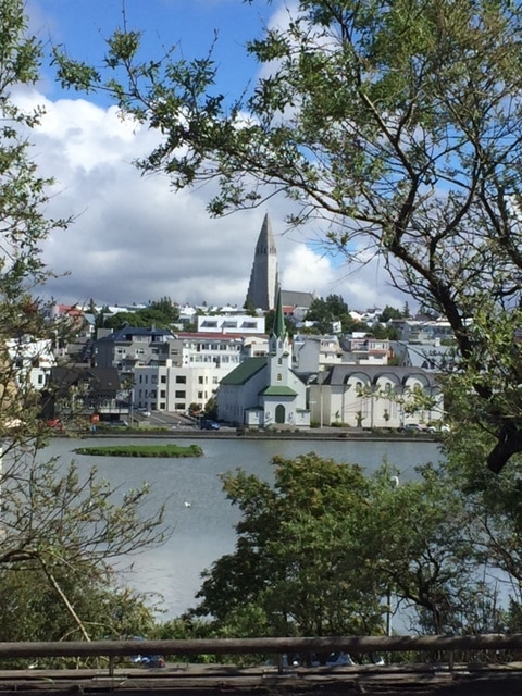
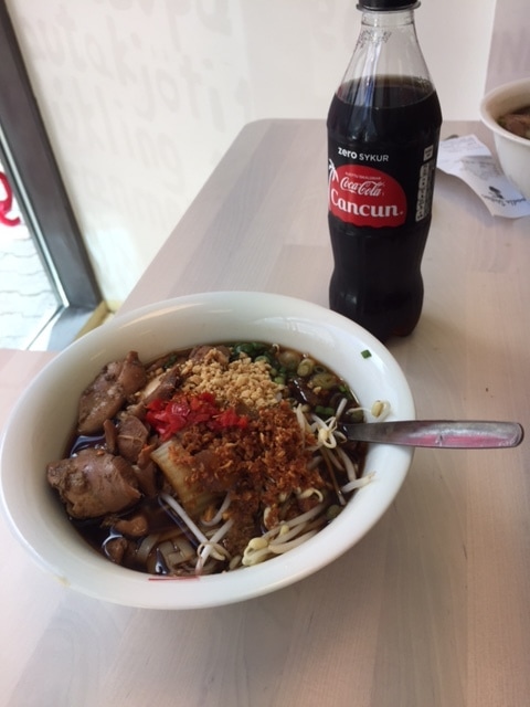
Today was a much less eventful day. We slept in and didn't leave our hotel until 10:30. We hiked a volcanic crater for about 30 minutes and then headed to the settlement museum near Reykjavik for a little more history and folklore. We will post our final thoughts on our Iceland trip from the airport tomorrow. 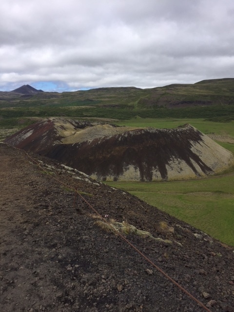 Volcanic craters on the western portion of Iceland. We slept in bit today and started exploring the Lake Myvatn area around 10:30 after a big breakfast at our hotel. Before we even got out of our hotel we saw a rare Arctic fox. There are a lot of volcanic attractions packed into a small area. We began right across the street from our hotel. The lake is quite big, but the portion of the lake that was by our hotel is special because it is full of pseudocraters. Normal craters form at the top of a magma chamber. These are "false craters" because they form with the help of water. The valley that is now the lake was filled with lava. Liquid water was trapped under it and turned to steam. This steam led to an explosive eruption in a place that usually has nonexplosive eruptions. You can see that water vapor was involved in the eruptions by looking at the rocks that the pseudocraters are made of. Notice all of the holes in the rock from the gas bubbles. Just a few minutes down the road we went into an interesting cave called Grjotagja. The cave has a lovely, natural thermal pool in it. It was used by locals recreationally until the 1980s when an eruption from Krafla filled it with lava! The lava is now gone but the water is too hot now to be pleasant. If you are a Game of Thrones fan, you might recognize it as the cave where Jon Snow and Ygritte spent some quality time together. Donna and I both agree that the highlight of our day was the Hverir geothermal area. We saw steam vents that were very powerful. Our favorite part of that were the mudpots. They were numerous and in many sizes. They form when sulfuric acid is created in groundwater and dissolves the soil as it bubbles away. Click here for a video of a mudpot in action. Just a few miles down the road, we visited the Krafla Geothermal Power Plant. They are boring into the Earth close to magma intrusions where steaming groundwater is plentiful. There are about 30 different bore holes to provide steam to this power plant. The steam is channeled in an extensive network of pipes to turbines that activate a generator to create electricity. There is no carbon dioxide or pollution from this process. Over 99% of Iceland's electricity comes from geothermal or hydroelectric power. That is why Iceland makes less greenhouse gas per person than any developed country. Click here to see a quick video of the power plant. About 2:00 in the afternoon we headed out of the Lake Myvatn area with intentions to visit some quaint fishing villages and find a thermal pool to soak in. We came upon some road construction and it was a bumpy ride through gravel. About 30 miles later, our car said we had low tire pressure. We stopped at a gas station to fill them with air. One was low, but not exceptionally so. About 30 miles after that, the low tire pressure warning came on again. We ignored it for a while and convinced each other that it was a faulty sensor. Once we got to a small town, I got out and told Donna I found the low tire. We had a flat! I called the car rental company and they basically told us to figure it out ourselves. Donna saw two men coming out of the only cafe in town and asked for help. They turned out to be the only mechanics in town! The were very kind to us and filled our tire and took us to their shop to repair it. The had us one our way in about 45 minutes. We feel very lucky to have found them. We had a delicious trout dinner in the next small town. It was $39 and was probably our best value. Our meal probably would have been at least $25 in the U.S. The fish was a big portion. I think I forgot to mention that you don't tip here, so that helps a little. We did get to finish our day at a thermal pool. It was in a little town called Hofsos. There was a big swimming pool that seemed like an infinity pool because of its proximity to the ocean. The hot tub was the best after a kind of stressful day. Tomorrow is our last day as we he back to Reykjavik.  Rare Arctic fox! Ha Ha! 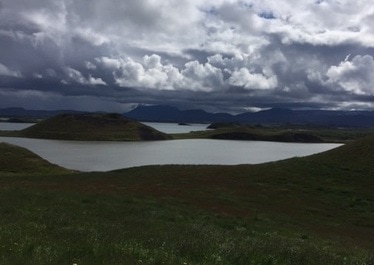 Everything that looks like an island is a pseudo crater. 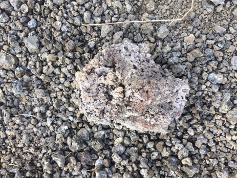 Igneous rock with holes from the water vapor. The pseudocraters are just piles of these rock with plant life colonizing them. 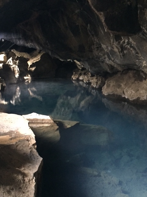 Cave from Game of Thrones 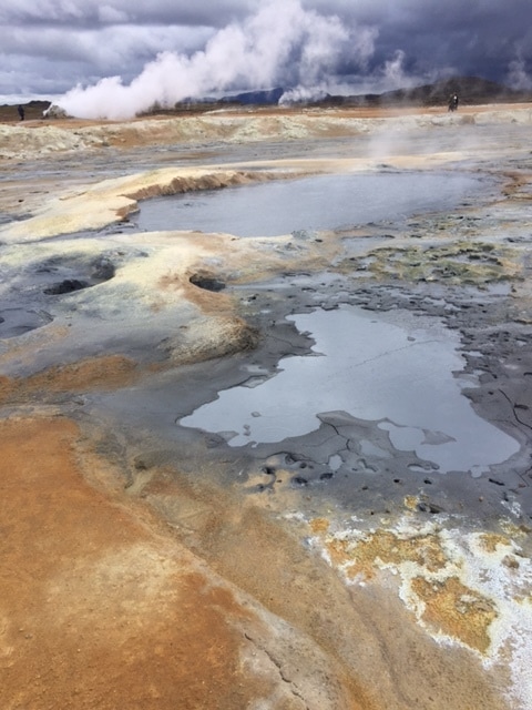 Hoverer hydrothermal region. Notice the powerful steam vent in the background. 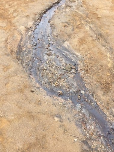 I noticed this little stream through the hydrothermal area. It is not hot, just a regular stream. Does it remind you of our stream table lab work? 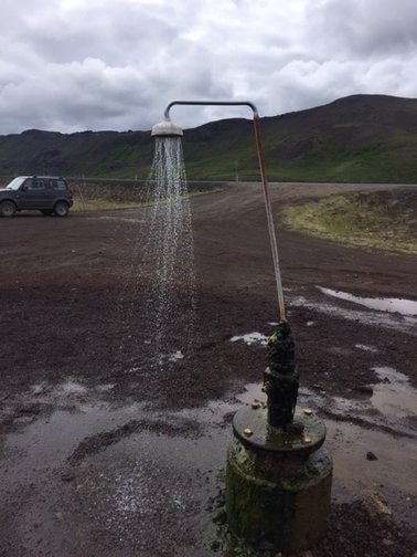 Icelandic Shower! The water was warm. 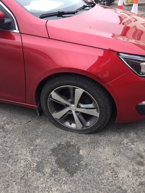 Oh no! 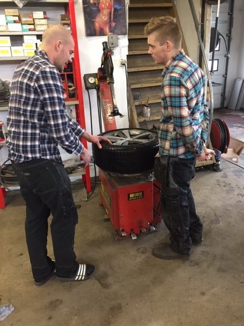 Villi and David-our Icelandic blessings! 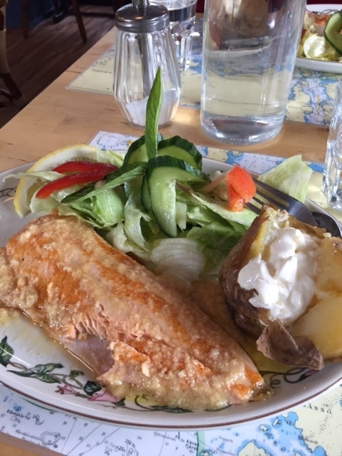 Fresh trout from near the Arctic Circle. 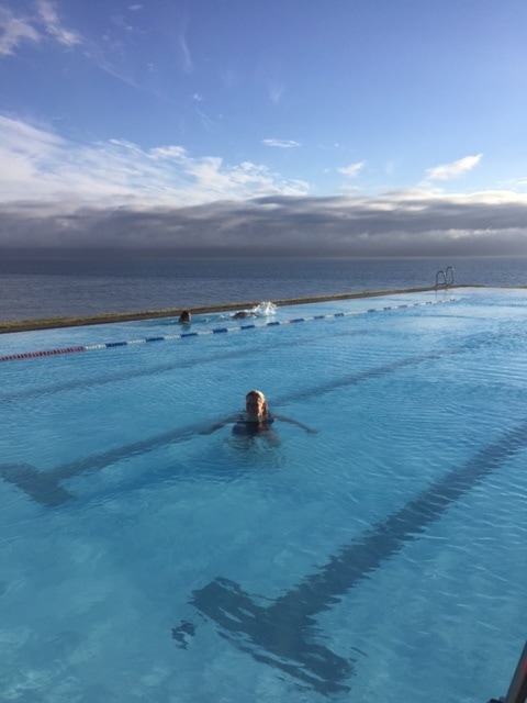 Good ending to a kind of stressful day! 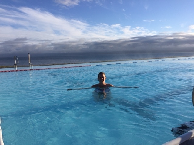 That is the Atlantic Ocean in the background. It is 9:00 as night in this picture. Notice how bright it still is. I am typing this at 11:00 and it still is not dark! Greetings from the eastern portion of Iceland! We started another early day because we had an appointment to take a Jeep tour to hike on a glacier. The tour did not end up being what we expected. We took this monster jeep up to the very top of the glacier, not on the bottom part of the glacier called the tongue. It took an hour and a half to get to the top. Most of that time was driving on the glacier. That was a bumpy ride and it was so cloud-covered it was like riding through a glass of milk. It was a claustrophobic feeling. When we finally got out to walk on the glacier, it wasn't glacial ice. It was the snow layer from the winter. Our guide name Tam was very enthusiastic and knowledgable. She said the snow that doesn't melt will get compacted into ice and add to the glacier below the snow that is almost a mile thick. Next, we drove a little further to the summit. You can see Donna walking to it in the second picture. Notice how fogged in it is. I told Donna walking through this was my worst nightmare. She said that we paid quite a bit for this nightmare! I asked Tam if you can usually see anything. She said that some days you can see to the ocean. Then she said to wait a few minutes because sometimes the sky will clear up. Next, we saw a peak of the sun and within 5 minutes we could see all the way down to the valley floor. Bowl-shaped cirques and an arete were clearly visible. Our nightmare turned into a pleasant surprise! You can see how happy we were! When we returned, Tam took some time to show us on the map exactly where we had been today. Click here to hear her explanation. You will get to hear how to pronounce these places in Iceland. I thought I would learn how to do this myself, but I have given up. Today we are drove from 4:00 to 12:00, if you think of Iceland like a clock. We started in the town called Hofn, which you pronounce more like Hopn, and journeyed to Myvatn. We drove the whole eastern portion. The road took us in and out of gorgeous fjords. Our intention was to drive the coast the whole way. Then, Donna took a cat nap. I took a wrong turn! I realized it when it turned to a gravel road so I woke Donna up. We discovered that we could make it to the same place, it would just be a more scenic route with slower-going roads. (Although, as you can see, the fjords were quite scenic!) My wrong turn actually led us to our favorite part of the day. Donna noticed there was a set waterfalls called Hengifoss and Litlanefoss. Our guidebook said they were easily accessible from the road. We interpreted that to mean it would be a quick stop for a photo op. Well...the path was accessible from the road, but it kept going and going and going. One hour and 15 minutes later we were to the top fall. We made it down in only 45 minutes. It was much more pleasant going downhill. Donna stopped for a drink from the river about halfway up. I joined her! We had no concerns about water pollution here. This country is very environmentally conscious, as are its visitors. As a guest here, we respect and admire their ways. This set of waterfalls has been the most challenging for me to understand. The hike was in three tiers. The first tier you come to is the river canyon. I thought this was the waterfall and was confused. I asked Donna where it was and she pointed way up! The second tier was Litlandefoss. It is pictured below. Notice the tilt of the basalt columns on the right. Remember that basalt is an igneous rock from cooled lava. Why do you think the basalt columns are tilted? I know the answer now, but I would like you to comment on possible explanations. Adults and students alike! DO NOT JUST GOOGLE IT! Focus on good science reasoning. Mom-you may not just say "A rock is a rock"! Every stone has a story! If I get enough good tries at explanations I will post the correct answer tomorrow. It seemed like we would never reach the top fall. It looked to be in our grasp to get there and then you would turn a corner and see another path heading straight up. Keep in mind we had not researched this stop since it was the result of my wrong turn. Finally, we got to the end of the trail with our best view of Hengifoss. Your next science challenge! Notice all of the reddish orange layers. All of the other layers are basalt from lava flows. What do you think the orange layers are? Same as above! Post possible explanations and I will reveal tomorrow. We headed from our hike to the biggest town in the East called Eglisstadir (population: 3,500). We ate the dinner pictured below. I had fish and chips tonight and Donna has chicken tandori. Our meals were around $30. It was good, but at home it would probably be a $12 meal. In case you were wondering, we did have lobster last night. We are keeping those prices private! :-) However, we are happy to share a picture of our friendly, Icelandic waiter. He was born and raised in Hofn. He said he was happy about the tourism boom in his country and seemed very genuine in his response. We asked his name, but there is no way I could attempt to spell it. Their names sound nothing like ours. Honestly, it sounds like they have phlegm in their throats when speak Icelandic, but their English is perfect. The weather was perfect today. We didn't even wear a winter coat up on the glacier. We also saw some interesting creatures today. Check out the picture of Rudolph below. (Wait-his nose is not red! Might be Prancer.) Also, there are over 500,000 free-range sheep in Iceland. That is almost double the citizens. They are everywhere! In September the sheep round up for winter is a big event! Tomorrow looks to be volcano day as we are getting closer to the Mid-Atlantic ridge. We are staying at the Sel Hotel in Myvatn tonight. Click here to check it out. 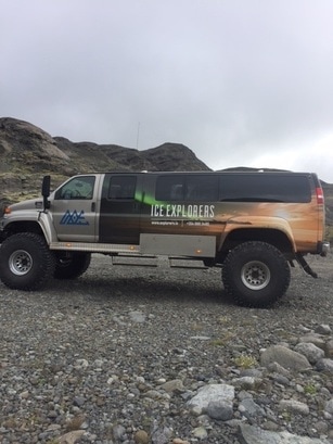 This was our ride up to the glacier! 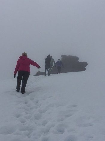 Donna trekking to the peak of the glacier. 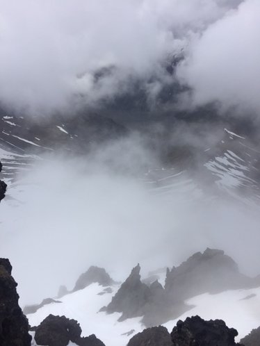 View from the top of the glacier when the fog lifted. Notice the arete on the right. 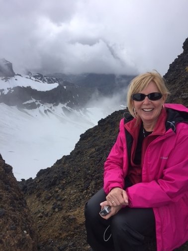 Happy the fog is clearing! 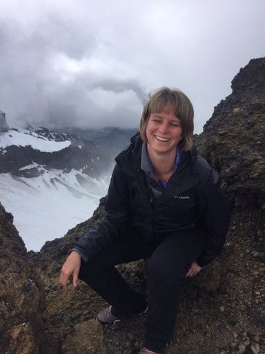 Happy that the fog is clearing and laughing because the basalt is a prickly seat! 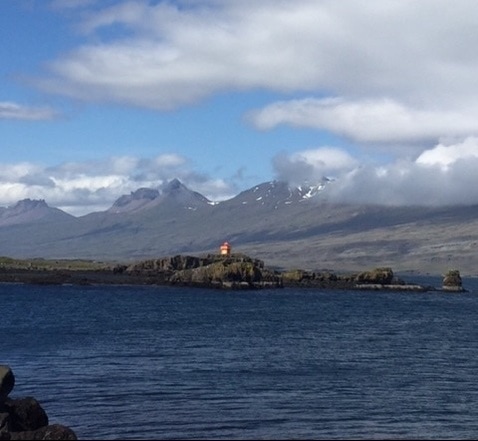 One of many amazing fjords along the east coast. 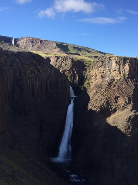 Litlandefoss. Notice the tilted basalt columns on the right. What do you think caused that? 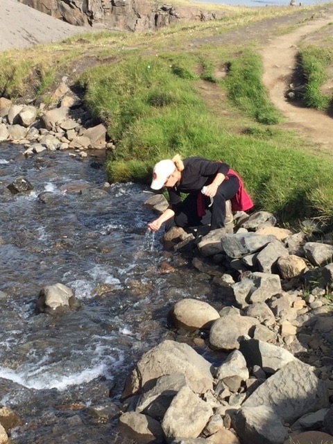 A refreshing drink before the push to the top! 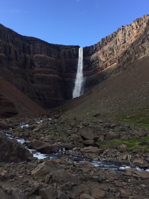 Hengifoss. What is the story of the orange layers between the basalt? 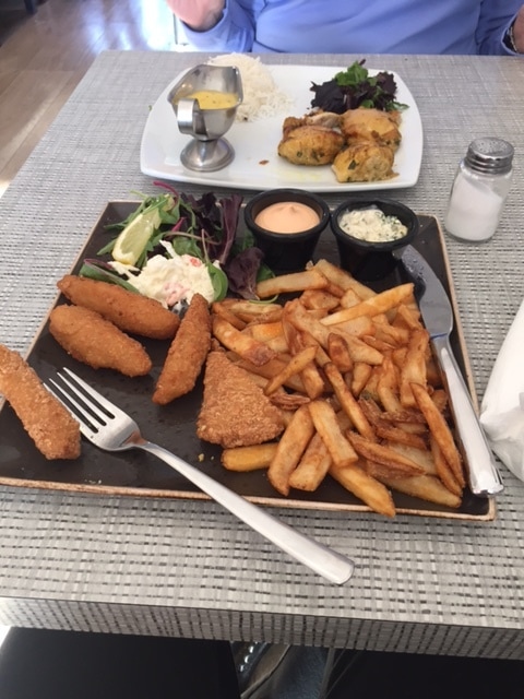 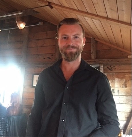 Friendly Icelandic waiter 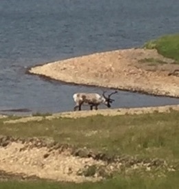 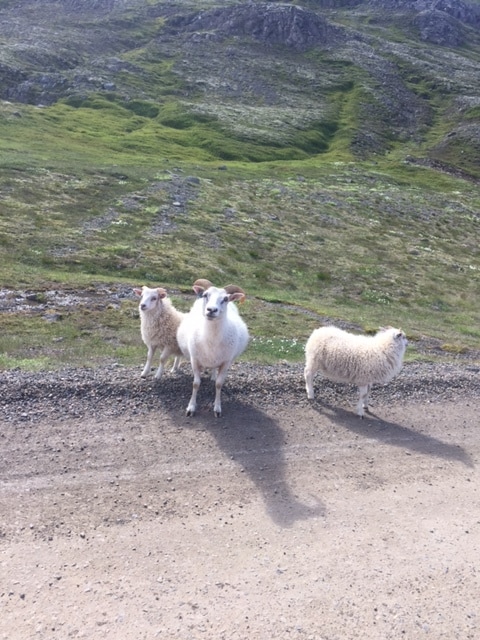 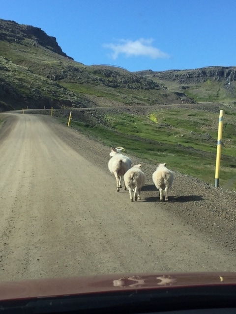 We started our day pretty early. We left the hotel by 8:30 after a small breakfast our our guesthouse. Our first challenge was filling up with gas. The credit card machine at the gas station has been the only language barrier so far! I somehow put the equivalent of $20 worth of gas in the gas and we were on the road! If you think of Iceland like a clock, we were driving from 6:00 to 4:00 today. (We are going counterclockwise around the country.) Our first stop was at an unusual rock formation at Dyrholaey. It is made of basalt entirely. This formed when magma cooled about 2 million years ago in the valley. The strange thing, like you see in picture 1, is that the bottom is made of columns and the top is irregular. Scientists think the bottom cooled into these common columns from the bottom up. The top of the formation is irregular because water filled the valley before it could completely cool. The present is the key to the past... You examine formations in the present and you can solve the puzzle of the past. This would be right up James Hutton's alley. (Remember meeting him? Old, bald guy...) Our first stop was quick, leaving plenty of time for our two big adventures today. The first of the two adventures took us into Vatnajokull National Park. We hiked up to on of the many glaciers in the park called Skatafell. Picture 2 is Skatafell glacier. Beautiful scenery there. We would have hiked a bit more, but we are doing a hike on a glacier tomorrow morning and we had to get to a boat ride by 2:00 today. Our main event today was a speed boat ride in the Jokulsarlon Glacial Lagoon. It was awesome! You didn't see anything from the road but piles of gravel. Once I walked on top of the gravel I realized that humans did not place the gravel there. I was looking at the terminal moraine that marked where the glacier used to be. This lagoon is being created by glacial melt. Due to global warming, the lagoon size is increasing a lot in recent years and they expect more increase this year due to the mild Iceland winter. As you can see in picture 3, the lagoon is dotted with icebergs that have broken off of the main glacier. This is a very dynamic situation. Our guide told us that even the biggest chunks of ice will melt in a week or less. In the hour we were on the water, we saw two big chunks break and flip! The boat ride itself was a lot of fun. I forgot to mention today is in the 60's and sunny! Perfect weather to see the glacial lagoon sparkle. The guide took us very close to the main glacier and he had to go quite fast navigating ice chunks the entire time. We had to wear a suit that would help us float if we fell in. Picture 4 shows Donna and I ready to go! Picture 5 shows the boats we rode on. We just sat on the edge and held on! Pictures 6, 7 & 8 are pictures of icebergs I took close up. Picture 9 is one of two seals we saw basking in the sun on an iceberg. Our hotel tonight is very nice. We are in a decent sized town named Hofn. Click here to check out our hotel. Picture 10 is the view out of our hotel room. We are situated in a harbor surrounded by mountains. We are heading to dinner in a few minutes. This place by the Atlantic is known for its lobster so we may not be able to pass that up! We are at the halfway point of our journey now. 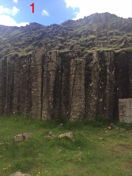 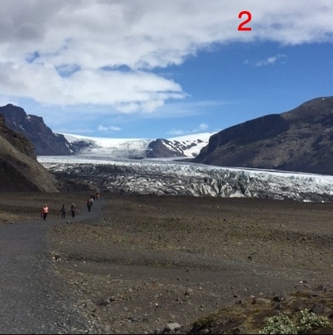 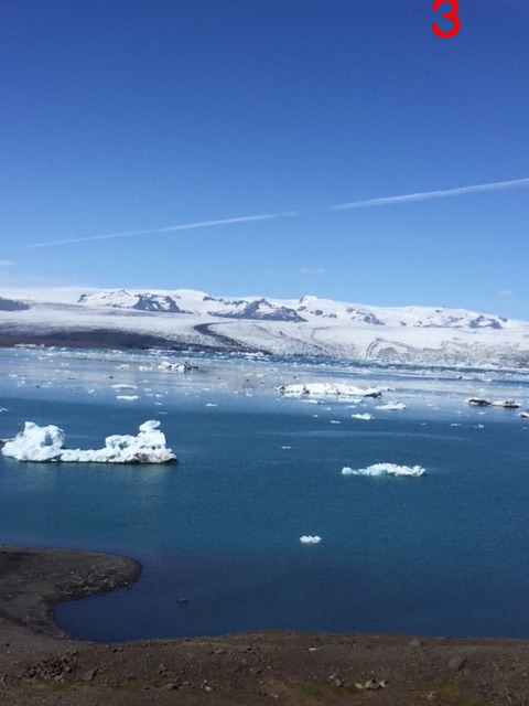 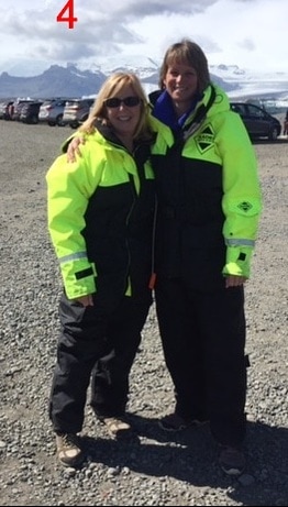 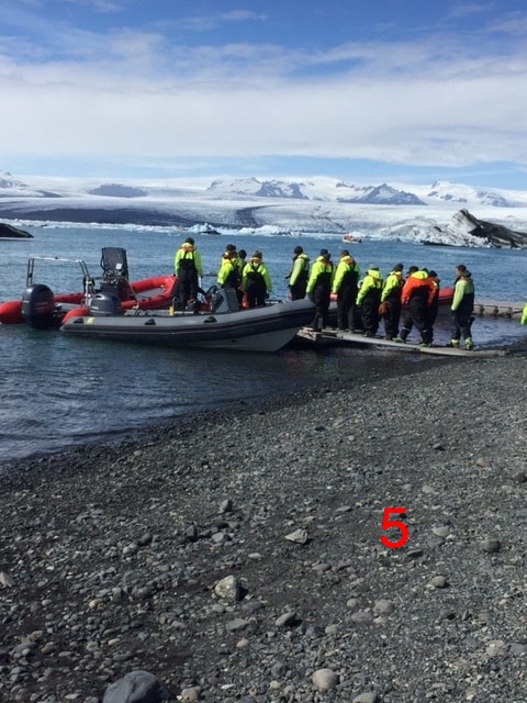 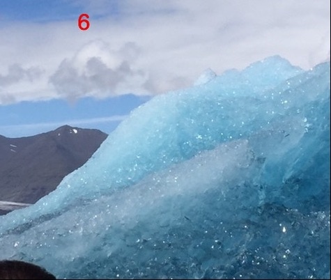 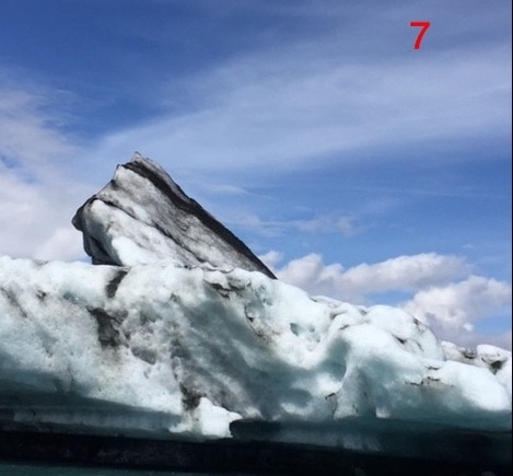 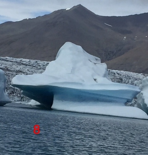 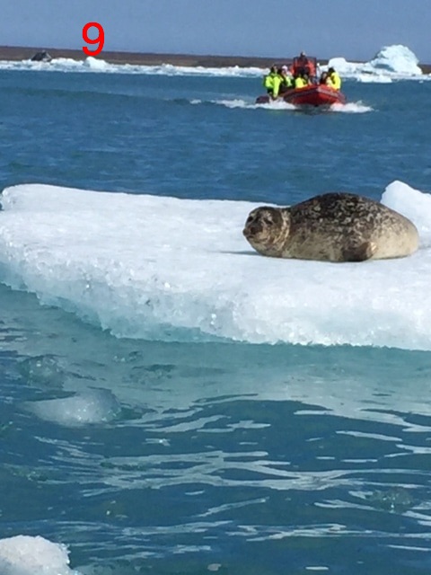 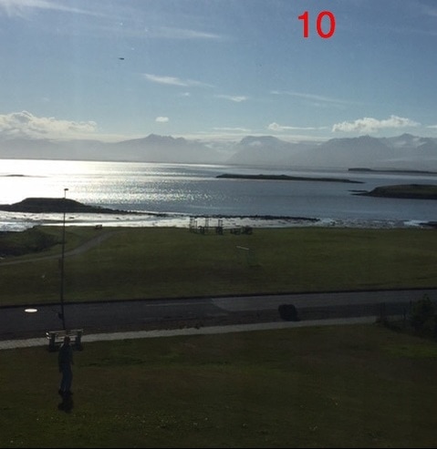 We started our day in Reykjavik this morning at 8:30 by getting our rental car and we just got to our hotel near the town of Vik on the Southern coast. It is after 11:00! We have had many adventures today. Even better than we imagined! Our first stop today was at Thingvellir National Park. It is only about 30 minutes from Reykjavik. It is historically important because this is where the first assembly met to establish Iceland's government. Of course, as you can guess, I was more interested in the science. Picture 1 is of Donna and I standing on the Mid-Atlantic Ridge. On our right is the North American Plate and on our left is the Eurasian Plate. These plates are diverging (splitting) at a rate of 2 cm per year. That is what allows magma to get to the surface, creating all the volcanic and hydrothermic features. Iceland is unique because there has been extra magma flow there, but this process called sea floor spreading is happening along the middle of the entire Atlantic Ocean. It is the major force that split Pangaea and still moves the continents today. We continued about 20 minutes up the road to an area named Geysir. It had hot springs, steam vents, mud pot and, of course, an erupting geysir. All of these features exist here because magma is close to the surface heating the ground water. The water is over 200 degrees! This reminded me of Yellowstone and Lassen Volcanic National Parks. It smelled like it, too. Stinky sulfur! Picture 2 is of a bubbling mud pot. Picture 3 is of the geysir called Strokkur erupting. It is not quite as tall as Old Faithful in Yellowstone, but erupts more frequently. It erupts about every 10 minutes! Only about 10 minutes more up the road and it was time for our first of 3 waterfalls today. This waterfall is called Gullfoss which means "golden waterfall" in Icelandic. It was breathtaking! Picture 4 shows the waterfall. Look for the rainbow in the picture. Picture 5 is of the canyon wall downstream. These are the basalt columns (igneous rock) that the church in Reykjavik from yesterday is patterned after. So far today our weather had been pretty good. Sprinkles while driving, but no big deal. Plus it was in the 50s. Then the rain really came! That did not stop us. No time to wait to see a volcanic caldera with a lake at the bottom. We put on our highly effective rain gear and hiked around the Kerid Crater. It is picture 6. This caldera formed when a magma chamber emptied too quickly and the mountain collapsed. The lake is actually spring water. That is where the level of ground water, called the water table, is. We had skipped lunch and were very hungry. We went to a restaurant called Kaffi Krus. Click here for the website if you want to check it out. Picture 7 is our meal. Donna got fish and chips with water ($29) and I got a cheese pizza, Italian salad and Coke Zero ($38). It was delicious with quick service. That was good, because we had a few more stops to make today! It is safe to say that the most fun we had all day was at our next waterfall called Seljalandsfoss. We spotted it from miles away. It was taller than Gullfoss, but not as wide. The best thing about this waterfall is that you could hike behind it! Even though the rain had stopped, we put our rain gear back on for this! Picture 8 is a view from the front. Notice the rainbow again. Picture 9 is a selfie I took halfway behind the waterfall. Notice my mood! It felt like being in a storm on the way behind it. Picture 10 is the reward you get for making it behind the falls. Finally, Picture 11 is of Donna and I after we made it back through the "storm" to the other side. We were laughing like little girls. It felt really good to laugh like that in this beautiful place. I know what you are thinking. Not another waterfall! This one was called Skogafoss. The challenge for this one came with picture 12. Notice the 500 steps to the right to make it to the top of the waterfall. Picture 13 is the view from the top. Notice the sun in the picture. It was around 9:00 p.m. when I took that picture. Our final stop tonight was really close to our guesthouse for the night. It is an island called Dyrholaey very close to Vik. The water you see in the pictures is the Atlantic ocean. This place is actually an island connected to the mainland with a road. It was formed from an offshore eruption of lava. Notice in picture 14 the arches from the ocean eroding the rock. Picture 15 shows other formations in the distance. These were part of the island once upon a time that have been more resistant to erosion so they still exist. Notice that the beach in the picture is black. That is because Iceland usually has nonexplosive eruptions that are low in silica. Silica is clear, so the absence of silica means a dark-colored igneous rock to get eroded into the sand. My final picture today, picture 16, is of the black sand beach. Notice the birds doting the beach. We are not sure what kind they are, but we wondered if they were in nesting pairs. Notice the mix of light and dark birds. We wondered if they were males and females. What a day! We saw all of that in about 200 miles of driving. We probably saw 30 more waterfalls than the ones we stopped at from the road. Our hotel tonight is called the Steig Guesthouse. It is much more rustic! Click here to see the website. Tomorrow our highlight will be a boat trip on a glacial lagoon. Thanks for keeping up with us! Hope you are enjoying! 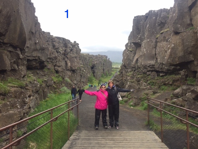 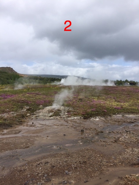 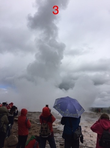 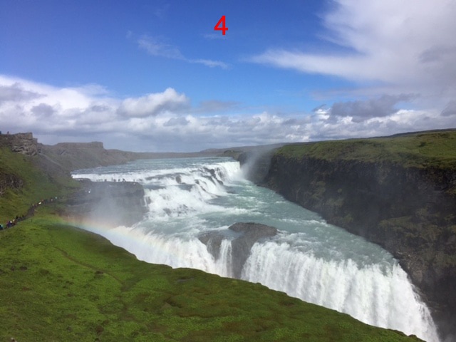 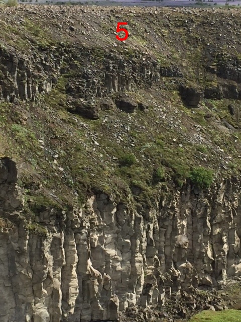 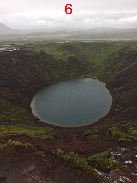 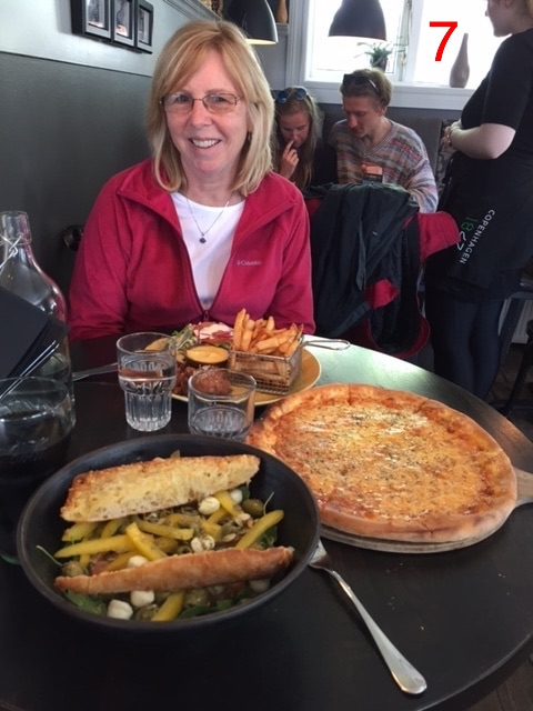 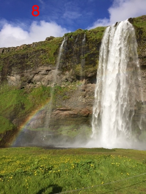 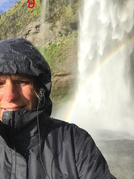 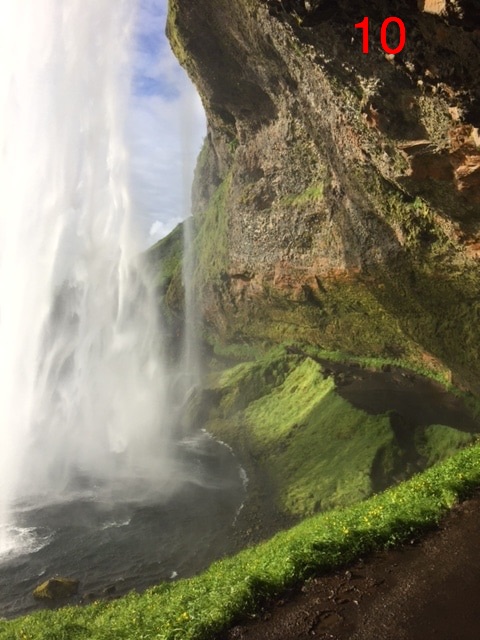 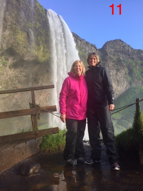 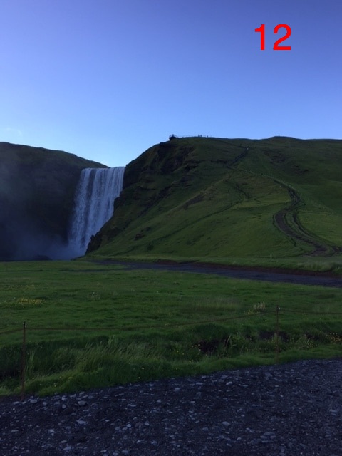 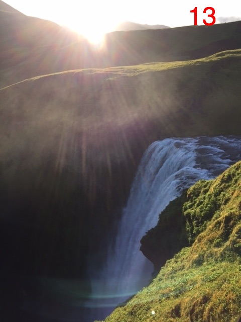 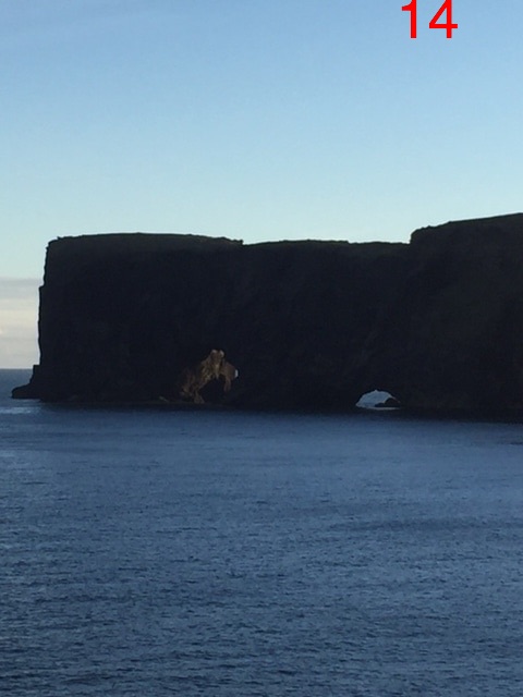 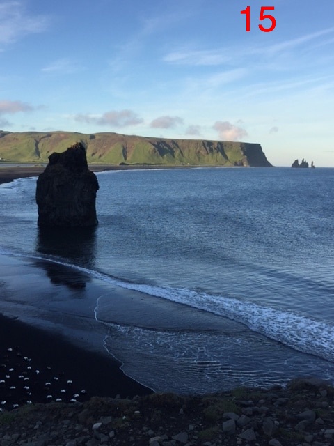 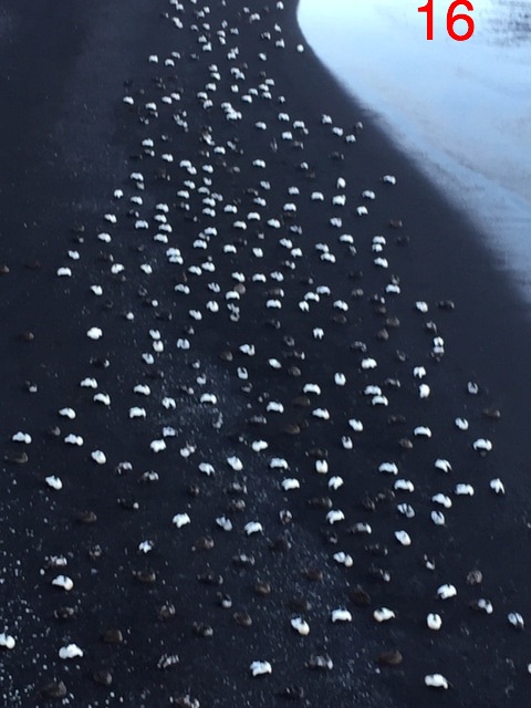 Mrs. Goodfleish (Donna) and I arrived in Iceland's capital at about 4:30 this morning after an overnight flight from Pittsburgh. We drove to Pittsburgh for the direct and less expensive flight instead of flying out of Columbus. Our driver from the airport told us that the sun went down at midnight and came up at 3:00 A.M. This is because of the extremely northern position of Iceland and the tilt of the Earth. Iceland is currently tilting toward the sun and receiving lots of light, making it their summer. Our driver said that winter is a depressing time because the daylight hours are opposite. |
 |  |
   |   |
